Kanu Links
Spanish River West
Branch
All photos will expand when you click on them
![]()
This page describes the West Branch of the Spanish River, from Biscotasing to the Forks. From the Forks, the trip can be continued down to the Elbow and possibly beyond to the Agnew Lake via the river. A side tour via Lake Pogamasing, Kennedy Lake and the Mogo River can be used to spice up the trip: there are crystal-clear lakes, huge cliffs, a turquoise pond that could have been lifted straight out of Killarney and one avoids the stretch of the Spanish that parallels the railway. That side trip will add an extra day to the trip and one needs to be prepared for some honest portaging. Click here for a description of the side trip.
The easiest access to this route is via the VIA railway: in Canada, their number is 1-800-361-1235
and this phone number may work in the US as well. Check their schedules as they keep
changing! 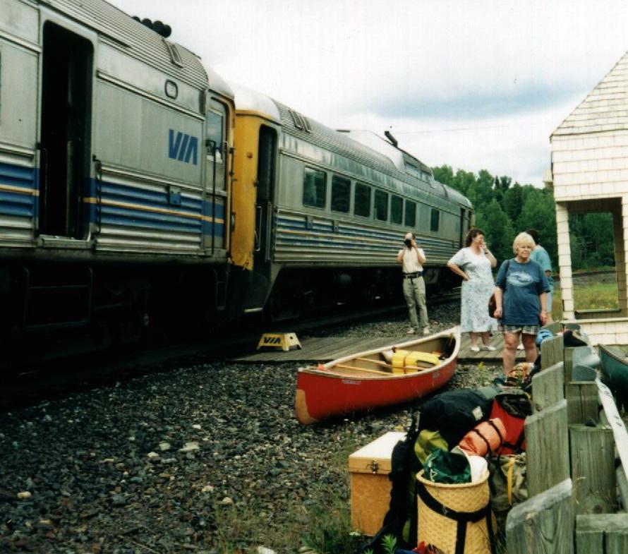 This year, the train
leaves Sudbury for White River every alternate day: Tuesday, Thursday and Saturday. I like
to leave the car at Cartier rather than Subury because it's more convenient, and have the
car shuttled to the Elbow by the folks from Fox Lake Lodge (705)965-2701. If you don't
mind driving more, you could use the dirt road into Biscotasing. And one can get a shuttle
at the General Store in Webbwood at the Trans-Canada Highway if one wants to paddle all
the way to Lake Agnew.
This year, the train
leaves Sudbury for White River every alternate day: Tuesday, Thursday and Saturday. I like
to leave the car at Cartier rather than Subury because it's more convenient, and have the
car shuttled to the Elbow by the folks from Fox Lake Lodge (705)965-2701. If you don't
mind driving more, you could use the dirt road into Biscotasing. And one can get a shuttle
at the General Store in Webbwood at the Trans-Canada Highway if one wants to paddle all
the way to Lake Agnew.
Distance over lake to reach river: 23 km
Total Distance: 66 km
Total Duration : 3 days (you may want to give yourself an extra day for a more leisurely
pace)
Portage Information
No. of Portages : 11
Total Portage Distance : 2,640 m
Average Portage Length : 240 m
Longest Portage : 500 m
Ratings
River Travel : Simple whitewater skills needed at low water, but good white water skills
required for higher water levels. 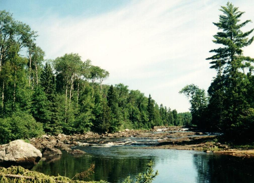 The trip was done at low water levels, and will not be representative
for different water volumes. Always inspect the rapids to determine whether they are
runnable.
The trip was done at low water levels, and will not be representative
for different water volumes. Always inspect the rapids to determine whether they are
runnable.
Lake Travel : Intermediate
Portaging : easy but frequent
Remoteness : intermediate
Maps
Federal Topo Maps (1:50,000) : Bisco(?) 41 O/8, Low Water Lake 41 P/4
Provincial Series (1:100,000) :
Other Maps: MNR (Ontario Ministry of Natural Resources) "Spanish River Canoe
Route", if you can get it...
Route Description
The following description was prepared after a trip on July 25 to July 27, 1998. The
water levels were low and whenever rapids were paddled, it was by the forgiving grace of
Ed's Oldtown Penobscot ABS canoe... The trip continued past the forks and where the water
levels were a bit better, partly because INCO let water out of Lake Pogomasing.
Day 1:
Train leaves Cartier at 11:35, arrives at Biscotasing at 1:30.
Paddle up Biscotasi Lake about 10 km (plenty of camp sites up the way), then
turn west and south around Wind Point to paddle 12 km down the lake
(no camp
sites) to the dam at the south end.
A large camp site (4 tents) on the shore about 1 km NW of the dam.
1. KM 23: Dam at Biscotasi Lake: portage left, 150 m at low water.
There is somewhere a shorter lift-over, we heard.
Paddle 1 km.
2. KM 24: Low falls: portage over island in centre 30 m, drop of 4 ft.
Paddle 2 km.
3. KM 26: Falls and Rapids: portage right 500 m (lower third could be lined or paddled at
higher water).
Paddle 2 km.
4. KM 28: Rapids, portage right 120 m or line left. Good camp site at bottom of rapids (2+
tents).
Paddle 3 km.
5. KM 31: 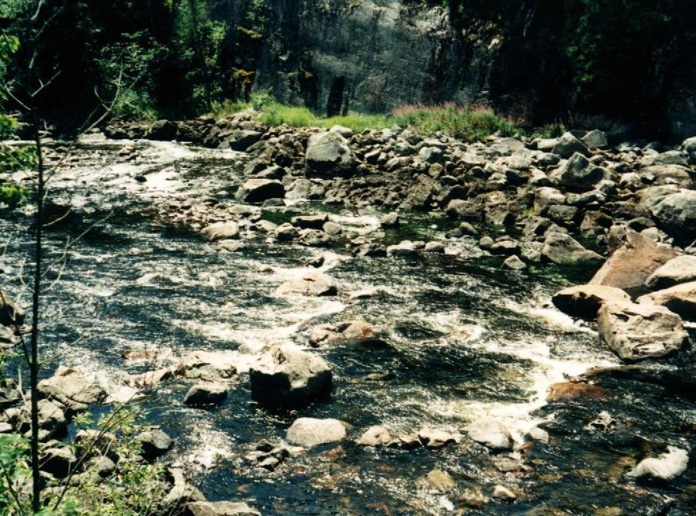 Rapids in canyon with large boulders, portage left 500 m.
Pretty camp site
Rapids in canyon with large boulders, portage left 500 m.
Pretty camp site
with good view at middle of trail (2 tents)
paddle 3 km
6. KM 34: mouth of Dead River, cottage on right
Here, the rivers widens to a lake. Paddle 4 km
(This lake has small camp site at north end and another small campsite on west
shore)
7. KM 38: Rapids at outflow, paddle or line on left
paddle .2 km across pond
8. KM 39: Rapids, portage on right, 100 m. Trail crosses logging road. The rapids could be
paddled with ABS canoes, and can be easily scouted from bridge
Paddle .3 km across small lake
9. KM 39: Rapids, portage 70 m right or line right
paddle 3 km to junction with Snake River.
10. KM 42: 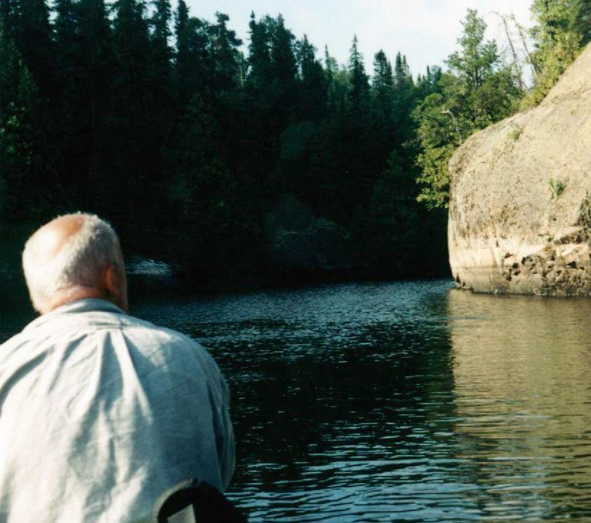 The river here widens to a lake
with low shores and there is little camping. A small site is at the
junction of the two rivers, on the point just south of a cottage.
Paddle 4 km to end of lake.
11. KM 46: There is a camp site is on the lake's left
shore, about half way down lake (3+ tents). One more camp site where river
leaves the lake, small, on right shore. Pretty.
Paddle 2 km through the channel with steep rocky shores and the lake
with large round island.
12. KM 48: At end of lake, there is a dock on right which is
the start of portage trail (300m and steep incline), but rapids can be run
after scouting. Boy's camp on right, supplied via Sinker Creek which
enters
on right.
Paddle 1 km to end of lake (small camp site on left)
13. KM 50: Rapids, run on right.
Paddle .3 km
14. KM 51: Rapids, Portage right 100m, with camp site (3+ tents).
Paddle .2 km
15. KM 51: Rapids, line left then run,
then paddle .5 km across still water
16. KM 52: Set of rapids, total length of about .4 km: first line on left,
then paddle or line.
You are now crossing Lebell Lake to proceed southward.
17. KM 56: Rapids, portage left 380 m, short paddle, then line left.
Paddle 1.2 km
18. KM 58: Portage left 240 m to bypass rapids and falls,
then cross 100 m pool
19. KM 58: Portage left 450m to bypass rapids.
Paddle 8 km to Forks of the Spanish. The next campsite is on an island at
the fork itself: it is small and has a steep landing. A large campsite is at the next set
of rapids, about 4 km downstream.
Click here to get back to Erhard's Home Page
Click here to get to Erhard's Favorite Paddling Areas
Disclaimer
The advice provided on this webpage has been compiled based upon 30 years experience canoeing in Ontario. Every effort has been made to ensure that the advice in this web site is correct. Even so, I do not accept any responsibility for errors or misrepresentations contained herein.
WARNING! This advice is intended for use by those with some prior experience in camping, canoe-tripping and backpacking. I do not assume responsibility for the safety of individuals, nor do I accept liability for any loss or damages that might arise in the course of following the advice presented in this web site.