Kanu Links
![]()
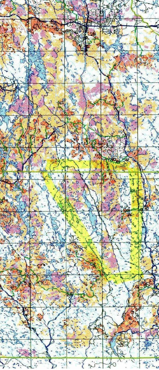
Below is the obsolete Logging Plan by E.B.Eddy for
the years 2000 to 2005
A new one has been presented by Domtar, the company that bought
out E.B.Eddy.
A copy of the new plan can be reviewed in the MNR office in Espanola or in the
MNR info center in Toronto, at Bay Street and Wellesley. Click here
to see my comments on that plan.
The Spanish River
Taken from the map "Spanish Forest - 2000 - 2005 Management Plan - Map 9 Information Centre Summary Stage 2" published Oct 27, 1998 by EB Eddy Forestry.
Wow! Look at the coloured areas, nearly all of it is classified as harvest area, as if they owned it! Preferred and secondary harvest area together with already logged areas make up for half the map. Its about time we stop this destruction and establish protected areas!
|
(lflcomment@webmail.mnr.gov.on.ca) |
Hon Mike Harris Premier of Ontario Legislature Building, Queen's Park Toronto ON M7A 1W3 Fax: (416) 325-3745 Tel: (416) 325-1941 |
Legend:
![]() Preferred Harvest Area
Preferred Harvest Area
Secondary Harvest Area
Tertiary Harvest Area
15 Years of Previous Logging
(the area outlined with the yellow hi-liter encloses Lake Pogomasing: the cottagers are not thrilled about the loggers coming in. My thanks to Kay Ward, who built the Pog Lake Lodge in 1948 with her husband Harry, for sending me this map)
For comments, email to erhard@interlog.com
Click here to display the details that the "Ontario Living
Legacy (formerly "Lands for Life")" has in store for the Spanish
. There is some protection, but the upper branches will only be narrow strips of park land
along the shore and the southern park pretty much neglects the left shore. If you think
the plan is lacking, speak up!
Click here to get back to Erhard's Home Page